


Tulane researchers discover large Mayan cities in Guatemala
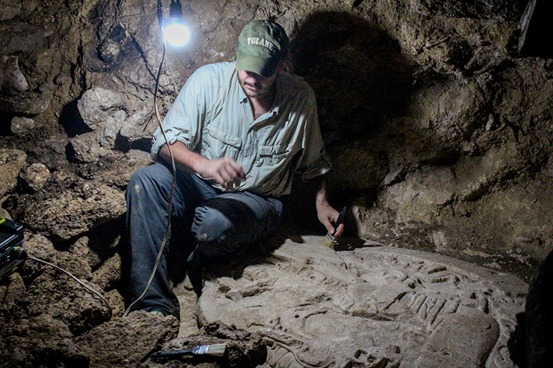
A recent discovery by Tulane archaeologists, as part of an international research team, has revealed more than 60,000 structures belonging to dozens of ancient Mayan cities in the Petén forest of Guatemala, leading them to believe that the Mayan civilization was far more complex and sophisticated than previously believed.
Thanks to funding and coordination from Fundación Patrimonio Cultural y Natural Maya, or PACUNAM, a non-profit Guatemalan foundation dedicated to the preservation of the region’s environment and culture, the researchers were able to map the region by using light detection and ranging technology, or LiDAR.
“LiDAR is revolutionizing archaeology the way the Hubble Space Telescope revolutionized astronomy,” Francisco Estrada-Belli, a research assistant professor in anthropology and with the Middle American Research Institute, said in an interview with National Geographic.
LiDAR sensors send out signals at various frequencies, some of which are able to penetrate through the thick canopy of the forest and collect data points from the ground below. In this way, scientists are able to create computer models of a region and detect geographical and man-made structures by digitally removing certain layers of the environment.
“The areas that we chose, the majority of them were places where archaeological projects had been working for at least 10 years, if not longer,” MARI Director Marcello Canuto said. “It wasn’t entirely terra incognita. Having said that, though, there were plenty of places that hadn’t been fully investigated in our region and in those areas, yeah, we found several sites that were entirely new.”
According to Canuto, LiDAR was instrumental in revealing archaeological sites that had previously been unstudied. By allowing them to survey more than 800 square miles of land, archaeologists were able to spot areas of Mayan civilization that were completely unexplored as well as large structures they may not have been able to recognize from the ground.
“What’s interesting about LiDAR, for the jungle, is that … what it lets us see are the things that were too small to see in the field and too large to see in the field,” Canuto said. “What I’m talking about is a terrace, wall or road that’s maybe a meter high but maybe five kilometers in length but at any given moment in the field you only see kind of a section of it.”
Though the data was collected and field-tested in the forests of Guatemala, the majority of the analysis needed to sort through the data and construct a three-dimensional map of the surveyed area was done by students and researchers at MARI.
“Tulane’s role was crucial because much of the primary analysis was done here,” Estrada-Belli said. “We were fortunate to have a computer lab equipped with Geographic Information System software and the trained students ready to carry out much of the tedious analysis.”
According to Estrada-Belli, the exploration which led to this groundbreaking find was the largest study of the Mayan civilization to date.
“It is the first time that more than 20 Ph.D.s and students from archaeology and related fields shared their data in real time,” Estrada-Belli said. “It showed Mayan cities at a scale never seen before. They are much bigger and more populous than we thought.”
He said he hopes more students and scholars choose to become involved in research projects such as this one so that they can help to reveal even more information about these ancient civilizations.
Your donation will support the student journalists of Tulane University. Your contribution will allow us to purchase equipment and cover our annual website hosting costs.
Leave a Comment